


Project Description
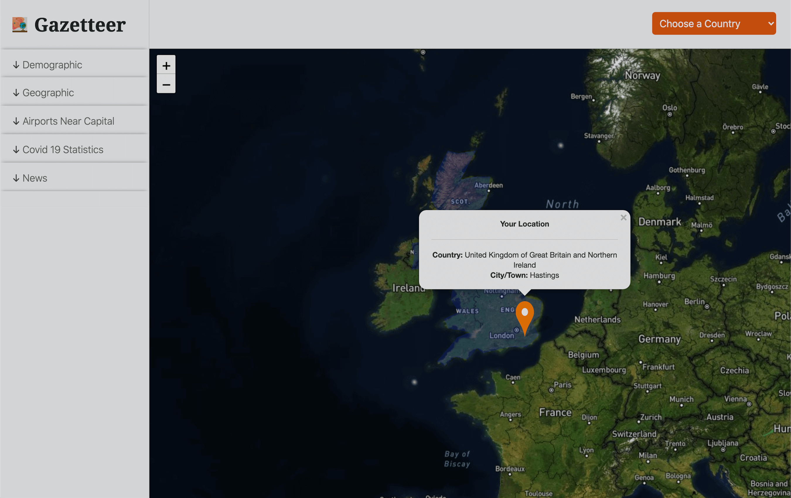
Gazetteer is a geolocation app. It is a project I undertook while studying on a full stack web
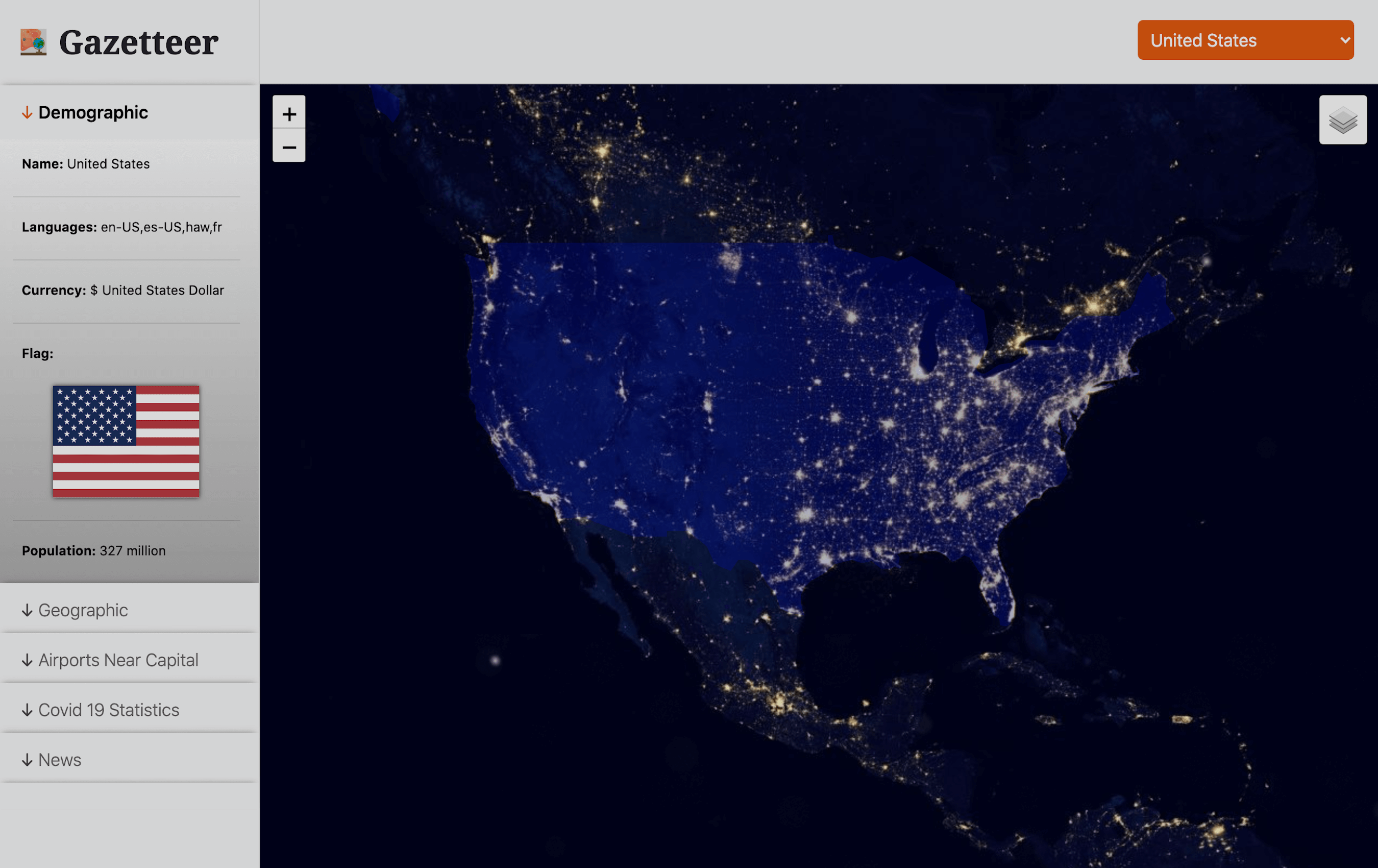
development course. When the main page loads, the country the user is located in will be
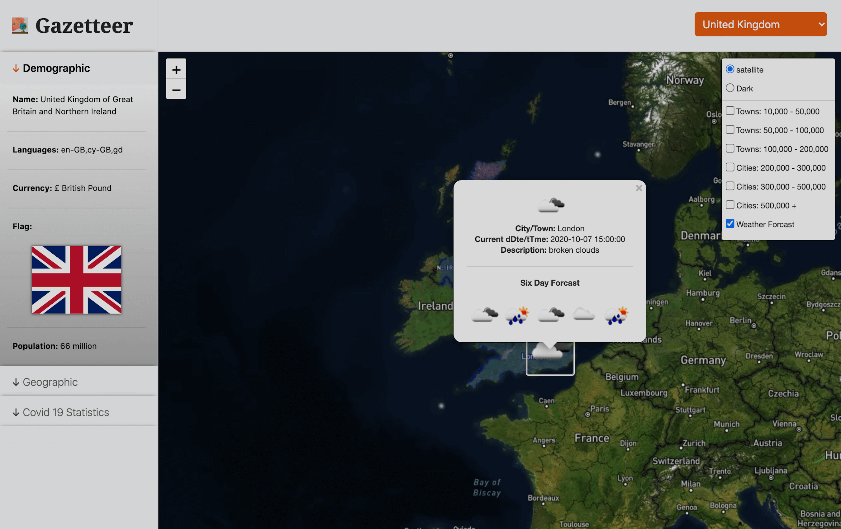
highlighted in blue and data related to that country will be accessible in the left hand side
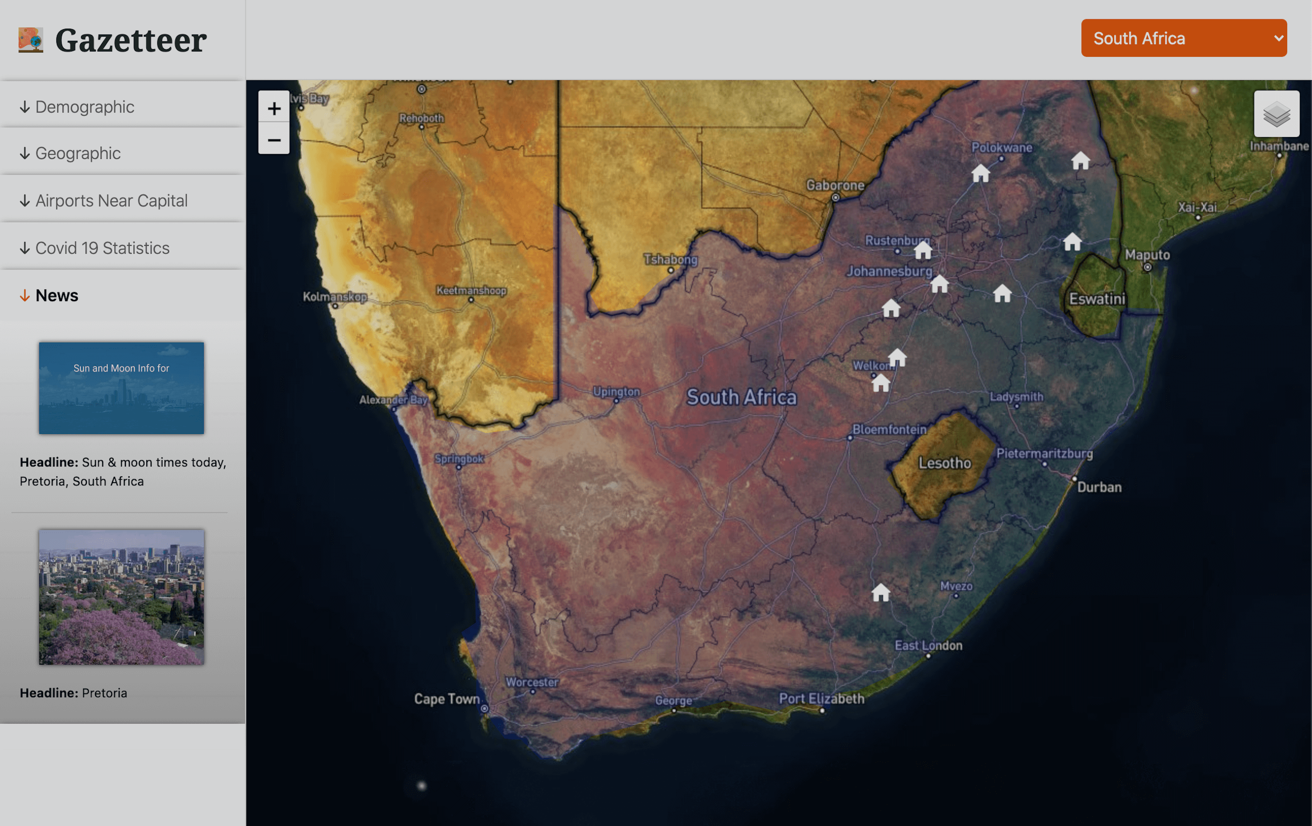
bar. Ths data includes; demographic data, geographic data, airports near the capital, Covid-19
statistics, and a news column. All the data is dynamically displayed using restful APIs.
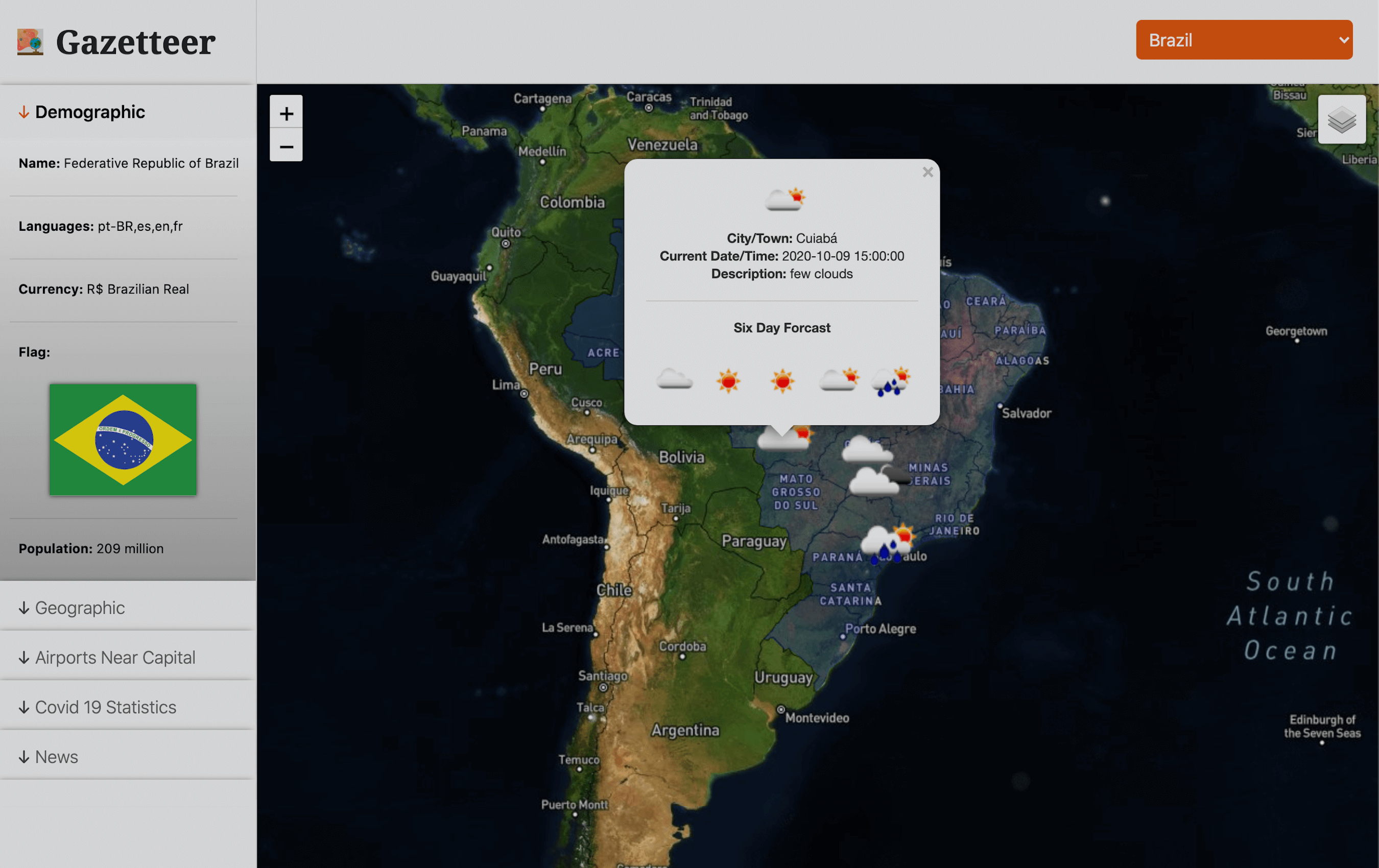
There is also a dropdown selection feature that allows you to choose any county in the world,
when a country is chosen this will also highlight the country and give you the same related
data. In addition to this, on the main map screen there is a button that allows you to change
the map layer from a satellite view to a night view. I have also added functionality that lets
you toggle on and off towns and cities within population tiers. These include tooltips when you
hover the mouse over them. Lastly I added another radio button so the user can check the weather
of all the cities with a population over a million (this also includes tooltips with a forecast
for the next five days.
This project was very enjoyable, but that is not to say it wasn't challenging. The methods
include the use of restful APIs, jQuery, AJAX, PHP, and cURL. I also used Geojson data to
highlight the country borders. Using all these technologies in conjunction with one another was
an essential learning curve. This project has given me a more holistic perception of programming
and what is possible to create by manipulating data.
The APIs used in this project are; Leaflet.js, Aero Data Box, Covid-19, Open Weather Map,
Reverse Geocoding and Geolocation Service, and World Geo Data.
Click here for GitHub repository